ReCap Pro Best Practices: From Raw Scans to Clean Project Clouds
ReCap Pro best practices for Scan to BIM: import, registration, cleaning, RCS/RCP workflows, QA checks, and delivery tips for Revit-ready point clouds.
BimzstudioNov 25, 202516 min
ReCap Propoint cloud registrationRCP RCSAutodesk ReCapScan to BIMpoint cloud cleaning
ReCap Pro Best Practices: From Raw Scans to Clean Project Clouds
Autodesk ReCap Pro sits at a busy intersection in Scan to BIM pipelines: it is often where raw scanner exports become project point clouds that Revit, Navisworks, and other Autodesk tools can consume efficiently. When ReCap work is disciplined, modelers receive registered, oriented, reasonably clean RCS/RCP data and move faster. When it is careless, every downstream hour costs more—misaligned floors, noisy ceilings, gigantic files, and mysterious coordinate shifts.
This article focuses on practical ReCap Pro best practices used by teams delivering commercial, healthcare, and industrial Scan to BIM. It is not a button-by-button manual. It is a field-to-federation playbook: how to structure projects, register with confidence, clean without destroying truth, optimize for Revit, and document QA so clients accept the cloud as a reliable source of truth.
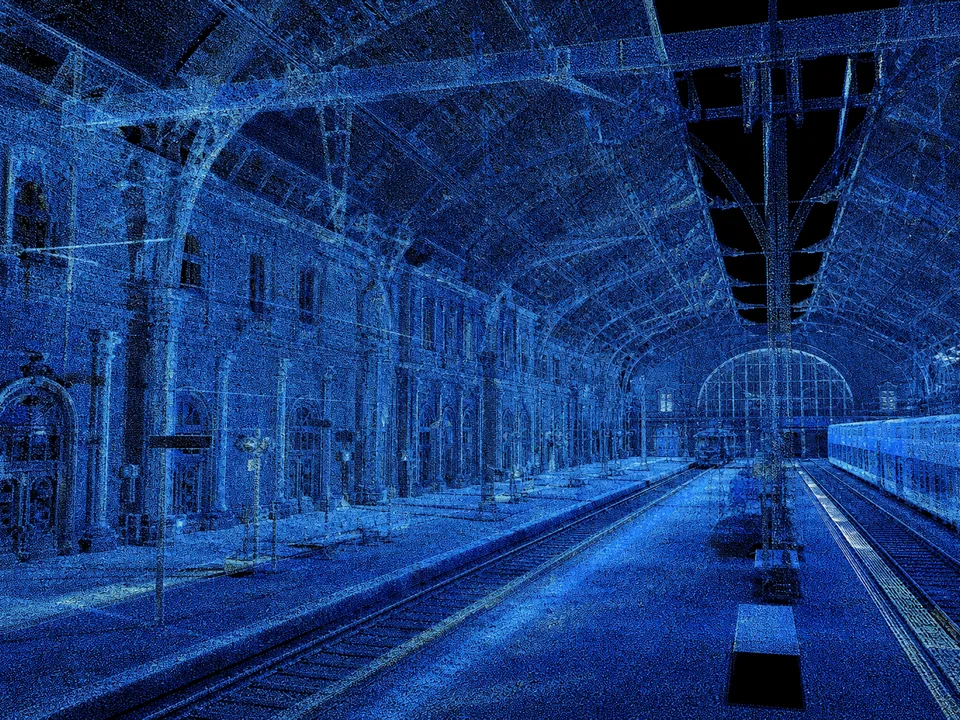
Index, CRS, and region strategy decide whether ReCap stays usable.
ReCap problems usually appear downstream:
Levels in Revit don’t match scanned floors
Cloud is rotated a few degrees from building grid
File sizes choke network drives and freeze session starts
Noise from reflective glass fills rooms with false points
Two wings register internally but disagree at the junction
Survey control was ignored; everything is “close enough” until steel is prefabricated
Teams blame Revit or the scanner. Often the real issue is ReCap project hygiene: inconsistent import settings, weak registration checks, aggressive decimation, or exporting without a coordinate strategy.
ReCap Pro can process laser scans and photogrammetry, create indexed RCS files, and assemble RCP projects. That power requires process. Best practices turn ReCap from a converter into a QA gate.
Why It Happens
Treating ReCap as only a file converter. Import → save → forget. No registration report, no cleaning policy, no origin strategy.
Mixed sensor chaos. Terrestrial, mobile, and drone data combined without stating which dataset governs accuracy.
Target discipline missing. Targetless registration can work, but long buildings and repetitive corridors need checks against control or surveyed targets.
Over-cleaning. Deleting “noise” that was actually thin conduit or cable trays.
Under-cleaning. Leaving moving people, bloom from windows, and duplicate overlapping scans that confuse modelers.
Coordinate postponement. “We’ll fix shared coordinates later in Revit” becomes expensive archaeology.
Version and setting drift across team members. Different people index with different quality settings; tiles disagree.
Industry Examples (EU/USA)
European projects
EU Scan to BIM deliveries often require metric coordinates tied to national grids or site survey systems, plus PDF registration QA. ReCap is commonly used to prepare RCS for Revit modeling while surveyors may also deliver E57. A German office renovation, for example, might import Faro or Leica exports into ReCap, register to site control, and publish RCP regions by floor for distributed modelers.
United States projects
US teams frequently standardize on ReCap + Revit + Navisworks. Large healthcare and airport jobs split RCP regions by wing. Mobile scan datasets are sometimes registered in other tools then brought into ReCap for Autodesk-friendly indexing. A US hospital project may reject clouds that lack a brief ReCap QA memo showing control residuals and known holes.
In both markets, clients increasingly ask for the working cloud and the method—not only screenshots.
Technical Explanation
Clean exchange formats reduce import pain and unit surprises.
ReCap roles in the pipeline
Ingest scanner outputs / structured data
Register or verify registration
Clean and segment
Index to RCS and organize RCP
Align to project coordinates
Publish packages for modeling and coordination
Sometimes registration happens in Faro SCENE or Leica Cyclone first. That is fine—ReCap then becomes the Autodesk delivery and optimization layer. Do not double-register blindly.
Structured vs unstructured
Structured scans (with scanner setup awareness) often register more robustly. Unstructured clouds (merged blobs) are harder to adjust and QA. Prefer keeping setup awareness as long as practical.
Registration quality
Evaluate:
Visual continuity across floors and wings
Target error statistics when targets are used
Cloud-to-cloud overlap residuals
Comparison to surveyed control points
Verticality of known walls / levelness of floors as sanity checks
If a corridor looks like a zipper, do not send it to modeling.
Cleaning philosophy
Clean in layers:
Delete ephemeral noise (people, cars)
Reduce glass bloom carefully
Crop irrelevant exteriors if scope is interior-only
Avoid deleting sparse but real MEP in dark ceilings
Document what you removed.
Coordinates and origins
Decide:
Real-world survey coordinates vs convenient internal origin
How Revit shared coordinates will consume the cloud
Units (meters vs feet) locked and verified
Place a known monument or grid intersection in the cloud annotations where helpful.
RCP/RCS performance
Index settings affect fidelity vs speed. For Scan to BIM, prioritize enough detail for the LOIN—pipe edges and wall faces—without shipping unnecessary ultra-noise. Split by floor/zone for multi-user modeling.
Best Practices
Publish project formats your modelers can actually navigate.
Create a ReCap project template with naming, units, and folder conventions.
Import with consistent settings; record scanner source and date.
Register (or verify) before heavy cleaning.
Always run a control or reality check against known dimensions.
Clean in reversible stages; keep a pre-clean archive.
Floors, wings, plant rooms as separate regions/files as needed.
Step 8: Index optimization
Choose settings appropriate to modeling LOIN; test open time in Revit on a sample.
Step 9: QA package
Screenshots of overlaps, residuals, known holes, coordinate note, version of ReCap.
Step 10: Publish to CDE
WIP → Shared after internal QA → Published after client acceptance.
Case Study
Project: Multi-wing clinic renovation, USA, metric consultant details from an EU equipment vendor mixed into an imperial site standard.
Issue: First ReCap publish looked fine visually but was 0.3° rotated from the building grid. Wall modeling from cloud fought the CAD grid constantly.
Fix: Team re-verified registration against three surveyed control points, corrected orientation in ReCap, re-indexed floor regions, and issued a QA note. Revit shared coordinates were re-established from the corrected cloud.
Result: Modeling productivity improved immediately. The lesson was procedural: no cloud Shared until control check is signed.
Common Mistakes
Decimating too hard for MEP modeling
Mixing units silently
Registering mobile and terrestrial without declaring hierarchy
Deleting sparse ceiling points that were real trays
One giant RCP for a 40,000 m² building
No archive of pre-clean state
Forgetting to save annotations of holes
Re-indexing differently per floor without reason
Sending clouds to modelers before Revit link smoke test
Assuming vendor “registered” means “project-ready”
Expert Tips
Keep a “truth” E57 or vendor project plus the ReCap delivery—never only RCS.
Use distance checks on door widths and known grid bays as quick field QA.
Color by elevation or intensity during cleaning to spot floors and glass issues.
For glass facades, accept some incompleteness rather than inventing points.
Name regions with level + zone codes matching the BEP.
If Cyclone/SCENE registration is primary, import carefully and don’t “improve” blindly.
Train modelers to report cloud issues with region names and screenshots in 24 hours.
Watch disk paths—network latency kills ReCap/Revit performance; use local SSD working copies with controlled publish.
Document ReCap version in the QA PDF for reproducibility.
For photogrammetry + laser hybrids, state which surfaces are photo-derived.
Future Trends
ReCap workflows increasingly intersect with Autodesk cloud collaboration, automated classification, and AI noise filtering. Expect better multi-sensor fusion tools and tighter CDE integration. Still, survey control literacy will remain the differentiator between pretty clouds and fabrication-safe clouds.
Real-time quality feedback in the field will reduce office registration surprises. Automated floor splitting will help, but human QA at junctions will stay essential.
Setting Up ReCap Projects for Multi-User Modeling
Large Scan to BIM jobs fail when everyone links one mega RCP over a slow network. Structure ReCap output for production:
One published coordinate framework for the whole site
Regional RCS/RCP sets by floor and wing
Naming that matches worksets and volume strategy in the BEP
A readme stating which region is authoritative for shared boundaries
Local SSD working copies with controlled republish rules
When two regions meet, include overlap so modelers can reconcile edges. Hold a boundary ownership rule: who models the shared wall between Zone A and Zone B?
Registration Verification Inside ReCap
Even if registration originated in SCENE or Cyclone, verify in ReCap before modeling:
Check continuity across imported clusters
Measure known door widths and grid bays
Inspect stair stacks in section
Confirm units with a taped reference if available
Compare against survey control annotations
If something is wrong, fix it upstream and re-export. Nudging clouds per modeler in Revit creates irreconcilable federations.
Cleaning Without Destroying MEP Evidence
ReCap cleaning tools can remove people, vehicles, and some noise. Overuse removes thin cable trays, conduit, and hanger rods that clash detection needs. A safe sequence:
Archive pre-clean
Delete obvious dynamics manually where needed
Apply mild filters
Inspect plant rooms and above-ceiling samples
Document remaining noise that modelers should ignore
Teach modelers the difference between noise and sparse real geometry. Intensity and elevation color modes help.
Photogrammetry and Laser Fusion Caveats
ReCap can incorporate photo-derived clouds. They are valuable for facades and texture context, but accuracy and noise characteristics differ from terrestrial laser data. In the project readme, label which surfaces are photo-derived. Do not let a beautiful textured facade become the dimensional authority for steel connections unless validated.
Performance Tuning for Revit
If Revit link times are painful:
Split regions smaller
Reduce unnecessary exterior points for interior jobs
Confirm SSD local paths
Avoid linking every floor when modeling one zone
Use appropriate index quality for the LOIN—ultra settings are not always better for walls-and-ducts modeling
Run a timed open test on a typical modeler laptop before declaring the package ready.
Delivery Checklist
Before Shared publish:
Units confirmed
Coordinate statement included
Registration/control QA attached
Regions named per BEP
Pre-clean archive stored
Occlusion notes included
Revit link smoke test passed
CDE permissions set
FAQ
Is ReCap Pro enough for all registration?
For many building projects, yes. Complex industrial plants or specialized survey networks may still start in Cyclone, SCENE, or survey software.
RCP vs RCS—what do modelers need?
RCS are the indexed scan files; RCP is the project/pointer assembly. Revit typically links through the RCP/RCS ecosystem—deliver as your pipeline standardizes.
Should we clean before or after registration?
Register/verify first so you don’t clean away features needed for alignment. Then clean for modeling clarity.
How do we handle huge airports/hospitals?
Parcel by phase/wing, maintain global control, deliver regional RCPs.
Can ReCap fix a bad field survey?
It can improve alignment within limits. It cannot invent missing geometry or repair gross control errors magically.
What QA should clients ask for?
Control residuals, overlap checks, known occlusions, units/coordinate statement, and a Revit link confirmation screenshot.
Summary
ReCap Pro best practices are about governance as much as clicks: consistent intake, verified registration, careful cleaning, coordinate discipline, region strategy, and documented QA. Treat ReCap as the quality gate between field capture and BIM modeling. When that gate is strong, Scan to BIM accelerates; when it is weak, every modeler pays the debt.
Coordinate Strategies That Survive Revit Shared Coordinates
Pick one strategy and document it:
True survey coordinates in the cloud, with Revit shared coordinates matching site survey
Internal project origin near the building for usability, with a documented transform to survey control
Hybrid: modeling origin convenient; published survey points included as reference elements
Problems arise when surveyors use strategy 1, BIM managers use strategy 2, and nobody writes it down. Include a coordinate diagram in the ReCap package: north, units, base point narrative, and two example coordinates for a known grid intersection.
Noise From People, Glass, and Specular Surfaces
Occupied buildings fill clouds with ghosts. Glass creates bloom. Specular metal creates spikes. ReCap cleaning should target these classes differently. People can usually go. Glass holes may remain holes. Metal spikes near equipment should be reviewed before deletion—sometimes they mark real edges.
Create a short visual guide for your team with before/after examples so cleaning quality is consistent across technicians.
Versioning and CDE States for Clouds
Point clouds are information containers. Apply ISO 19650-style states:
WIP while registering/cleaning
Shared after internal QA for modeling kickoff
Published after client acceptance
Archived when superseded by a better registration or a new survey epoch
Never overwrite a Published cloud in place. Issue a new revision and announce impacts to in-progress modeling.
Common ReCap-to-Revit Failure Patterns
Cloud appears shifted after someone “fixed” shared coordinates mid-project
Floor regions overlap with different elevations for the same slab
Intensity-only clouds make dark plant rooms unreadable—consider alternate display modes
Modelers complain about “bad scans” that are actually bad crops cutting ceiling MEP
Track these patterns in your lessons-learned log.
Onboarding Checklist for New ReCap Technicians
Before unsupervised publish rights, a technician should demonstrate:
Correct unit setup on a known sample
Control or dimension verification
Safe cleaning that preserves sparse MEP
Region split matching a BEP map
QA PDF completion
Successful Revit link smoke test
CDE upload with proper state and naming
Certification can be internal and lightweight, but it should exist. Most cloud disasters are process disasters created by capable people without a shared definition of “done.”
Pair new technicians with a peer reviewer for their first three projects. The reviewer’s job is not to rebuild the cloud—it is to catch missing control checks, over-cleaning, and ambiguous coordinate statements before modelers inherit them.
Work with Bimzstudio
Bimzstudio works with registered point clouds and ReCap-ready packages daily as part of Scan to BIM delivery. If you need Revit-oriented clouds with clear QA, coordinate control, and modeling LOIN alignment for EU or USA projects, connect via bimzstudio.com.