
BIM & Point Cloud Solutions
Our firm delivers end-to-end Building Information Modeling (BIM) and Point Cloud processing services, bridging the gap between real-world physical environments and precision digital workflows. With expertise spanning laser scan data acquisition through full-scale BIM coordination, we support architects, engineers, contractors, and facility managers at every stage of the project lifecycle.

3D modeling
Room Measurement
2d planning
Why Work With Us
We combine field-proven point cloud expertise with disciplined BIM authoring practices to deliver models and drawings that are accurate, coordinated, and immediately usable. Our team operates across time zones, maintains fast turnaround cycles, and scales to project demands — from single-building surveys to multi-site portfolio programmes.
Frequently asked questions
Technical Workflow
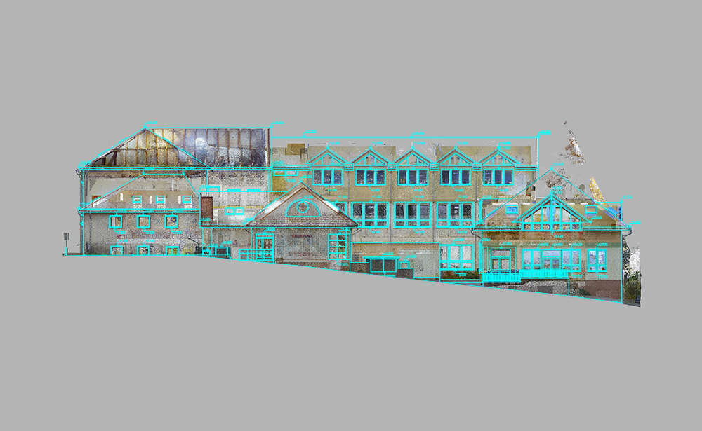
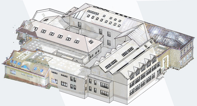
We import point cloud data (typically in .E57 or .XYZ formats) directly into the ArchiCAD environment. Using the “Lidar” data as a 3D template, we build native ArchiCAD elements—walls, slabs, doors, and windows—ensuring they align perfectly with the spatial coordinates of the scan.
We stay up-to-date with the latest releases (e.g., ArchiCAD 27/28/29) but can provide deliverables in older versions to maintain compatibility with your firm’s specific software version and workflow requirements.
Yes. When standard library parts don’t match the unique architectural features found in the point cloud, we can create or customize GDL (Geometric Description Language) objects to ensure the model is both visually accurate and parametrically functional.
ArchiCAD is excellent for heritage projects. We use the Morph tool and complex profiles to accurately capture ornate cornices, vaulted ceilings, and irregular structural shifts found in historic point clouds.
We follow a strict modeling protocol to ensure the digital model matches the point cloud within specified tolerances (e.g., +/- 5mm or 10mm). We can provide an accuracy report that highlights where the as-built reality differs from idealized “straight” architectural lines.
Based on your project requirements, we can assign composite skins to walls and slabs. If the exact internal buildup is unknown, we model the total thickness found in the scan and tag the elements for further investigation.
The primary deliverable is a native .PLN (Solo Project) or .PLA (Archive) file including all loaded libraries. We can also provide .IFC files for OpenBIM collaboration and .BIMx Hyper-models for mobile site viewing.
Yes. We are experienced in adhering to specific graphic standards, including the 3F Graphic Charter and other European BIM standards. This ensures that pen weights, layers, and building material classifications align perfectly with your internal office standards.
Absolutely. We ensure all elements are correctly classified (IFC mapping) and that the project uses the correct sea-level coordinates or local survey points, making the model ready for clash detection or structural analysis in other platforms.
Pricing is typically based on:
- Total Area: Square meters or square footage.
- Complexity: Standard office space vs. highly ornate heritage sites.
- Detail Level: Whether you need a simple shell or a full interior model with MEP and furniture.
We optimize the model by using efficient modeling techniques and managing the point cloud display settings. For very large sites, we can split the project into “Hotlinked Modules” to ensure your computer handles the file smoothly.
We can use your office-specific .TPL file to ensure all layers, pens, and favorites are pre-set according to your team’s preferences.