

As-Built Drawing Services
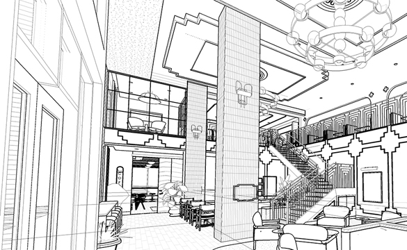
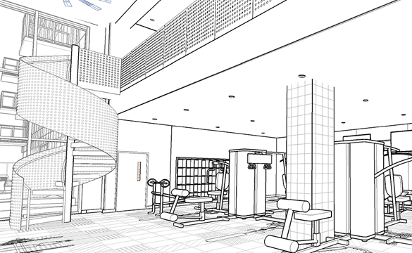
We produce accurate, construction-grade as-built documentation from scan data or field surveys, formatted to client and local authority standards. Deliverables include annotated plans, reflected ceiling plans, roof plans, and detailed elevations.
3D modeling
Room Measurement
2d planning
Why Work With Us
We combine field-proven point cloud expertise with disciplined BIM authoring practices to deliver models and drawings that are accurate, coordinated, and immediately usable. Our team operates across time zones, maintains fast turnaround cycles, and scales to project demands — from single-building surveys to multi-site portfolio programmes.
Frequently asked questions
General Information
As-Built drawings (also known as record drawings) represent the building exactly as it exists today. Unlike “Original Construction Drawings,” which show the design intent, As-Builts capture all changes, additions, and deviations that occurred during or after construction.
They are essential for:
- Renovations: Providing a precise starting point for architects.
- Facility Management: Managing maintenance, space planning, and emergency exits.
- Compliance: Meeting local building authority requirements for occupancy or fire safety.
- Real Estate: Providing accurate square footage and floor plans for leasing or sales.
We use 3D Laser Scanning (LiDAR) technology to capture the building’s geometry. This method is far more accurate than manual tape measures or distos, as it captures millions of data points to create a “digital twin” of the space.
By using laser scan data, we typically achieve an accuracy of ±5mm to 15mm. This allows us to document real-world conditions, such as walls that are out of plumb or floors that have settled, which manual measuring often misses.
Yes. In fact, many of our projects involve “blind” documentation where no original plans exist. We create the entire set from scratch based on our site scans.
Depending on your needs, we provide a full set of documentation:
- Floor Plans: Walls, doors, windows, and room dimensions.
- Reflected Ceiling Plans (RCP): Lighting, HVAC grilles, and ceiling heights.
- Elevations: Exterior or interior wall views showing finishes and heights.
- Sections: Vertical cuts through the building to show structural relationships.
- Site Plans: Building footprint relative to property lines and landscape.
We deliver files in standard industry formats:
- AutoCAD (.dwg) – Fully layered and ready for editing.
- PDF – High-resolution, scaled, and ready for printing.
- Revit (.rvt) – If you require a 3D BIM model instead of 2D CAD.
Yes. We can follow your specific office standards, or we can use international standards (like AIA or ISO). If you have a specific Graphic Charter, we ensure all line weights, layers, and annotations match your requirements perfectly.
The timeline depends on the scale and complexity of the building. For a standard residential or commercial unit, we typically deliver the first draft within 3 to 5 business days after the site data is processed.
To give you an accurate estimate, we generally need:
- The approximate total area (sq. meters or sq. feet).
- The location of the project.
- The specific drawings required (e.g., “I only need floor plans” vs. “I need a full architectural set”).
- The current state of the building (empty vs. occupied/furnished).
Absolutely. We have the technical capacity to document large-scale projects, including factories, warehouses, and multi-story office complexes, ensuring every column and utility line is accurately placed.
If you have already performed the scanning locally, you can send us the raw data (E57, RCP, etc.) via secure cloud storage. We will process the data and draft the drawings remotely, delivering professional results regardless of your location.