
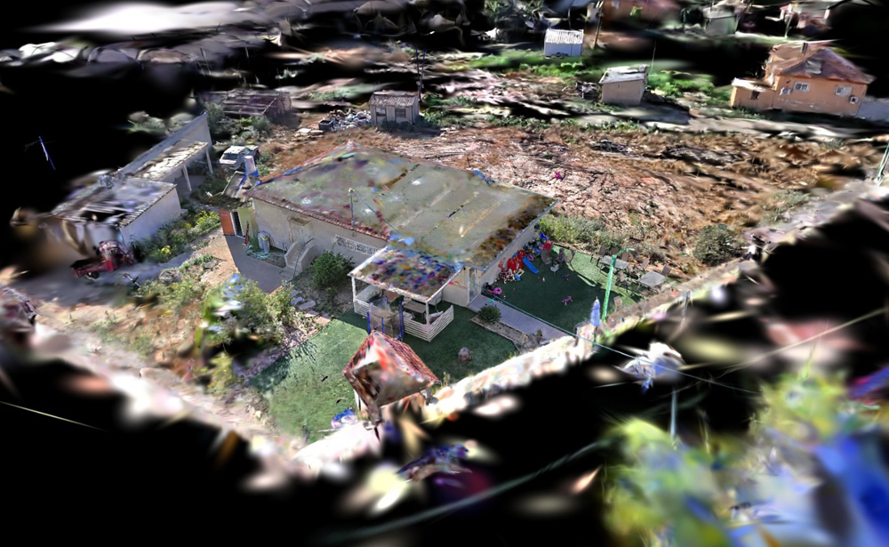
Gaussian Splat Generation
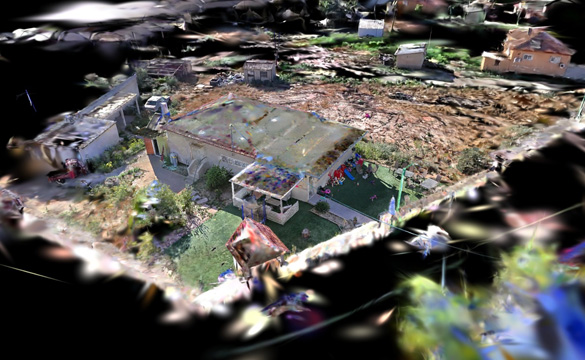
Gaussian Splat Generation: We convert drone or handheld video footage into photoreal, fully explorable 3D Gaussian Splat scenes — captured, cleaned, and delivered as a browser-ready viewer link. Unlike a traditional photogrammetry mesh, a splat scene preserves fine visual detail (reflections, foliage, fine textures) while rendering in real time, making it ideal for marketing walkthroughs, construction progress capture, and as-built visualization alongside our Scan-to-BIM models.
BIMzStudio — Emerging Technology Services
Gaussian Splat Generation
Photorealistic, navigable 3D scenes from your drone footage or LiDAR scan data — shareable in any browser, no software required.
Get a Quote →What Is Gaussian Splatting?
3D Gaussian Splatting (3DGS) is a next-generation reality capture technology that converts overlapping drone video or photography into an immersive, photorealistic 3D scene — rendered in real time directly in a web browser.
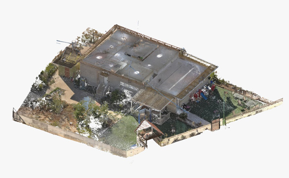
Unlike traditional point clouds, which are accurate but visually sparse and require specialist software to view, a Gaussian Splat looks and feels like being inside the actual space. Anyone on your team — or your client — can open a link and walk through a fully navigable 3D model with no app, no download, and no training.
Unlike photogrammetry meshes, Gaussian Splats handle reflective surfaces, glass, metal cladding, and complex geometry with exceptional fidelity — precisely the surfaces where traditional photogrammetry produces artifacts and errors.
Major platforms including NVIDIA, Autodesk, Bentley Systems, DJI, and Esri have already integrated Gaussian Splatting support. In August 2025, the Khronos Group standardized the SPZ format for 3DGS — marking the shift from research technology to production infrastructure.
Our Process
Data Submission
Share your drone video footage, drone imagery set, or existing point cloud (E57/LAS/RCS) via Google Drive, WeTransfer, or your preferred platform. We confirm receipt and assess data quality within 24 hours.
Processing & Reconstruction
We process your imagery through 3DGS reconstruction pipelines — structure-from-motion alignment, dense point cloud generation, and Gaussian primitive optimization — to produce a photorealistic splat model. LiDAR-anchored workflows are available for projects requiring geometric accuracy.
Quality Check
We review the splat for visual completeness, surface accuracy, and navigability. For LiDAR-anchored splats, we verify geometric alignment against the scan data to ensure measurement reliability.
Delivery
You receive a shareable browser link (hosted on a professional splat platform) plus raw .splat / .ply / .spz files for your own use. Clients can navigate the model, take measurements, and add annotations directly in-browser — no software needed.
Applications
As-Built Documentation
Photorealistic record of existing conditions — more readable to clients than a point cloud, shareable with anyone on the project team.
Construction Progress Monitoring
Weekly drone-to-splat workflow creates 4D timeline of site progress. Stakeholders walk the site remotely without visiting in person.
Heritage & Cultural Documentation
Permanent digital record of historic buildings, monuments, and sites — explorable online with photorealistic detail.
Stakeholder Presentations
Share a browser link instead of explaining a point cloud. Architects, clients, and owners can understand the space immediately.
Facility Inspections
Roof, facade, and infrastructure inspections from drone footage processed into navigable splats for remote review and documentation.
Real Estate & Hospitality
Immersive property walkthroughs that surpass traditional 360° photo tours in visual quality and spatial understanding.
Why Gaussian Splat?
| Feature | Point Cloud | Gaussian Splat |
|---|---|---|
| Visual realism | ✗ Sparse dots | ✓ Photorealistic |
| Viewable without specialist software | ✗ Requires ReCap / CloudCompare | ✓ Any web browser |
| Reflective / glass surfaces | ~ Limited | ✓ Excellent fidelity |
| File size | ✗ Very large (GB+) | ✓ Compact (25–300 MB typical) |
| Shareable to clients | ✗ Not easily | ✓ Single browser link |
| Geometric measurement accuracy | ✓ Survey-grade | ~ Good when LiDAR-anchored |
| Input: drone footage | ✗ Requires LiDAR | ✓ Drone video sufficient |
What You Receive
| Deliverable | Details |
|---|---|
| Hosted Splat Link | Browser-shareable URL. Clients navigate the 3D scene, take measurements, and add annotations. Works on desktop, tablet, and mobile. No login required for view-only access. |
| Raw Splat File | .splat / .ply / .spz format for your own hosting or integration into platforms like 3DVista, Splat Labs, or Niantic Scaniverse. |
| LiDAR-Anchored Splat (optional) | When combined with your point cloud data, the splat is geometrically referenced — enabling reliable measurements inside the visual model. |
| Processing Report | Summary of input data quality, reconstruction parameters, and any coverage gaps or surface limitations noted during QC. |
What We Need From You
Drone Video / Imagery
Overlapping drone video (4K preferred) or photo sets with 70–80% overlap. DJI, Skydio, Autel drones all supported. Higher overlap = better splat quality.
360° Camera Footage
Ricoh Theta, Insta360, or similar 360° imagery sets for interior spaces. Ideal for room-by-room building documentation.
Existing Point Cloud (optional)
E57, LAS, RCS, or RCP files for LiDAR-anchored splat generation. Provides geometric accuracy layer on top of the visual splat.
Project Scope
Area size, intended use (documentation / presentation / inspection), and any accuracy requirements or platform preferences for hosting.
Common Questions
Do I need special equipment to capture the data?
No. Most modern DJI drones (Mavic, Air, Mini series) can capture suitable imagery. A standard 4K drone video with good overlap is sufficient for high-quality splat generation. We will advise on optimal flight patterns for your specific site size and layout.
How is a Gaussian Splat different from a Matterport scan?
Matterport creates 360° photo tours that jump between fixed waypoints. A Gaussian Splat is a true continuous 3D scene — you move freely in any direction with full spatial context. Visual quality is dramatically higher, especially on complex surfaces like glass, metal, and fine structural details like pipes and conduit.
Can my client view the splat without any software?
Yes. We deliver a shareable browser link. Your client opens it in Chrome, Safari, or Edge on any device — desktop, tablet, or phone — and can navigate the full 3D model immediately. No app installation, no account, no plugins required.
How accurate is a Gaussian Splat for measurements?
A photogrammetry-only splat provides visual reference but limited measurement accuracy. When we combine your drone imagery with LiDAR scan data (LiDAR-anchored workflow), the splat becomes geometrically reliable at approximately 3 cm accuracy — sufficient for most AEC documentation and planning decisions.
What is the typical turnaround time?
Standard delivery is 3–5 business days from data receipt, depending on scene size and complexity. Rush delivery is available. We will confirm the timeline with you during the quote process.
What file formats do you deliver?
Hosted browser link + raw .splat / .ply / .spz files. Compatible with Splat Labs, 3DVista, Niantic Scaniverse, and other professional splat hosting platforms. LiDAR-anchored versions can also be delivered as georeferenced point clouds alongside the splat file.
Ready to Try Gaussian Splat?
Send us your drone footage or existing scan data and we'll assess your project for free. Most sites can be processed into a full Gaussian Splat within 3–5 business days.
Start Your Project →Why Work With Us
We combine field-proven point cloud expertise with disciplined BIM authoring practices to deliver models and drawings that are accurate, coordinated, and immediately usable. Our team operates across time zones, maintains fast turnaround cycles, and scales to project demands — from single-building surveys to multi-site portfolio programmes.
Frequently asked questions
Drone video for exteriors and larger sites, or handheld/gimbal video for interiors. We can also advise on the best capture pattern before you shoot, to make sure coverage is sufficient for a clean reconstruction.
Point cloud and Scan-to-BIM models are built for engineering accuracy — dimensions, clash detection, construction documentation. Gaussian Splats are built for photoreal visualization and walkthroughs. Many clients use both: point cloud for the model, splat for the presentation.
A web-embeddable viewer link by default, plus exportable splat files (.ply / .splat) for use in your own pipeline or third-party viewers on request.
Do I need special equipment to view the finished splat scene?
No. The delivered scene runs directly in a standard web browser — no app, plugin, or VR headset required, though it also works well in VR if you have one.