
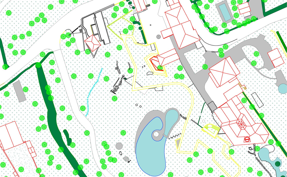
Drone Photogrammetry Processing
Drone Photogrammetry Processing: We convert aerial imagery from your drone survey into orthomosaics, digital surface models (DSM), digital terrain models (DTM), contour lines, and 3D meshes — processed in Agisoft Metashape with georeferenced accuracy for site surveys, roof inspections, earthwork volume calculation, and topographic mapping. Every deliverable is checked against ground control points where available, so measurements and volumes can be trusted for engineering use.
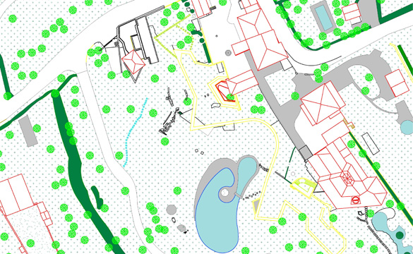
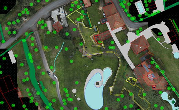
BIMzStudio — Drone Data Processing Services
Drone Photogrammetry Processing
We process your drone imagery into precise orthomosaics, DSMs, point clouds, and BIM-ready deliverables — without you needing to fly anything new.
Get a Quote →Service Overview
BIMzStudio is a remote data processing studio. We do not fly drones — we process the imagery you or your survey team already captures. If you have raw drone photos or video from a DJI, Skydio, Autel, or any other platform, we convert that data into professional, georeferenced 3D deliverables.
Our photogrammetry processing workflow uses Agisoft Metashape and Pix4D to produce survey-grade outputs from your imagery — orthomosaics, Digital Surface Models (DSMs), point clouds, 3D mesh models, and BIM-ready datasets — all in standard industry formats.
This service is ideal for surveyors, engineers, and AEC firms who capture drone data in the field but need a processing specialist to turn raw imagery into accurate, project-ready deliverables. You focus on fieldwork — we handle everything from image alignment to final file delivery.
Outputs are compatible with Autodesk Revit, AutoCAD Civil 3D, ArcGIS, QGIS, CloudCompare, and all major BIM and GIS platforms. We can take your processed point cloud directly into a Scan-to-BIM workflow if required.
How It Works
Upload Your Imagery
Share your geotagged drone photos or video files via Google Drive, WeTransfer, Dropbox, or any platform. Also share any GCP (Ground Control Point) coordinate data if survey-grade accuracy is required. We confirm receipt and data quality within 24 hours.
Alignment & Dense Reconstruction
Images are aligned using Structure-from-Motion (SfM). We build a dense point cloud from the aligned cameras, then generate the DSM, DTM, orthomosaic, and 3D mesh. GCPs are imported at this stage for georeferencing and accuracy refinement.
Quality Verification
We check RMSE at checkpoints, point cloud density, and visual orthomosaic quality for artifacts or misalignment. Any issues are flagged and corrected before delivery.
Deliverables + Report
Final files are packaged in your requested formats with an accuracy report documenting RMSE, coverage statistics, and processing parameters. Delivered via download link within the agreed timeframe.
What You Receive
| Deliverable | Format & Description |
|---|---|
| Orthomosaic Map | Georeferenced, geometrically corrected aerial image. 1–3 cm/pixel resolution. GeoTIFF format — importable directly into AutoCAD, Civil 3D, ArcGIS, and QGIS. Suitable for site plans, progress documentation, and design overlays. |
| Digital Surface Model (DSM) | Elevation model including all features (buildings, vegetation, equipment). GeoTIFF raster. Used for volumetric calculations, cut/fill analysis, and drainage design. |
| Digital Terrain Model (DTM) | Bare-earth elevation model with structures and vegetation filtered out. GeoTIFF raster. Used for topographic surveys and site grading design. |
| 3D Point Cloud | Dense, colored (RGB) photogrammetric point cloud. LAS / LAZ format. Importable into CloudCompare, Autodesk ReCap, Trimble RealWorks, and Revit. Can feed directly into our Scan-to-BIM workflow. |
| 3D Textured Mesh | Photorealistic surface model with draped texture. OBJ / FBX / GLB format. Used for stakeholder visualization, clash detection overlays, and virtual site walkthroughs. |
| Contour Lines | CAD-compatible contour lines at specified intervals (0.5 m, 1 m, etc.). DXF / DWG format for Civil 3D and AutoCAD. Derived from DTM. |
| Gaussian Splat (add-on) | Photorealistic browser-navigable 3D scene generated from the same drone imagery. Shareable via link. See our Gaussian Splat service for details. |
| Accuracy Report | PDF document: RMSE at GCPs and checkpoints, point cloud density statistics, coverage map, processing parameters, and software details. |
Applications
Construction Monitoring
Weekly drone imagery processed into orthomosaics and DSMs — compare progress against design, track earthwork volumes, and document site conditions over time.
Topographic Survey
Site surveys from drone imagery processed to survey-grade DTM and contour lines for grading design, drainage analysis, and site feasibility studies.
Scan-to-BIM Input
Photogrammetric point cloud processed and handed off directly into our Revit or ArchiCAD Scan-to-BIM workflow — exterior building envelope modeling from drone data.
Roof & Facade Inspection
High-resolution orthomosaic and mesh from drone imagery for remote roof condition assessment, facade inspection, and defect documentation without scaffolding.
Volume Calculations
Stockpile measurement, cut/fill calculations, and earthwork quantity takeoffs from DSM data. Delivered with a volume report and CAD surface files.
Heritage Documentation
Drone-based photogrammetry of historic structures processed into georeferenced point clouds and textured mesh models for preservation records and restoration planning.
What We Need From You
Geotagged Drone Images
JPEG or RAW photos with embedded GPS coordinates. 70–80% forward overlap, 60–70% side overlap recommended. Any drone brand supported — DJI, Skydio, Autel, Parrot, and others.
GCP Coordinates (if needed)
CSV or text file with surveyed GCP coordinates in your project coordinate system. Required for sub-5 cm survey-grade accuracy. Not required for relative accuracy or visual documentation projects.
Project Scope
Site area (hectares / acres), required accuracy, coordinate system (WGS84, local grid, etc.), and which deliverables you need. We will confirm feasibility and timeline before processing begins.
Site Coverage Map (optional)
A rough sketch or KML/KMZ of the site boundary helps us verify that imagery coverage is complete before processing starts — saving time if any gaps need to be re-flown.
Accuracy Reference
With RTK/PPK positioning and properly surveyed GCPs, drone photogrammetry typically achieves 1–3 cm horizontal and 2–4 cm vertical accuracy. Without GCPs (using GPS geotag only), expect 5–15 cm accuracy depending on drone positioning system. We advise on the right approach for your project's accuracy requirements during the quote stage.
Tools & Software
Agisoft Metashape
Primary photogrammetry processing software. Professional-grade SfM and MVS pipeline for high-accuracy orthomosaics, DSMs, and point clouds.
Pix4D
Alternative processing for agriculture, inspection, and precision mapping workflows. Supports multispectral (NDVI) processing for specialized surveys.
Autodesk ReCap
Point cloud cleaning and preparation for Revit import. Used when photogrammetric point clouds feed into our Scan-to-BIM workflow.
CloudCompare
Point cloud analysis, accuracy verification, and format conversion. Used for RMSE checking and QC before final delivery.
Common Questions
Do you fly drones?
No — BIMzStudio is a remote data processing studio based in Dhaka, Bangladesh. We process drone imagery captured by you or your local survey team. We do not provide drone flying or field capture services.
What drones are compatible?
Any drone that captures geotagged imagery is compatible — DJI Mavic, Air, Mini, Phantom, Matrice series; Skydio; Autel EVO; Parrot Anafi; and others. The key requirement is overlapping geotagged photos (70–80% forward, 60–70% side overlap recommended).
How many images do you need?
It depends on site size and required detail. A typical 1-hectare site at standard resolution requires roughly 200–400 images. We can advise on flight planning parameters (altitude, overlap, speed) before you fly to ensure sufficient coverage.
Can the point cloud output be used directly for Scan-to-BIM?
Yes. The photogrammetric point cloud we deliver (LAS/LAZ format) can be imported directly into Autodesk ReCap and then used in Revit for as-built modeling. We also offer combined packages where drone photogrammetry processing and Scan-to-BIM modeling are done as a single project.
What is the typical turnaround time?
Standard processing: 24–72 hours for small sites (under 5 hectares). Larger sites or complex deliverable sets (DSM + mesh + orthomosaic + point cloud) typically take 3–5 business days. Rush delivery is available on request.
What coordinate systems do you support?
All standard coordinate systems — WGS84, UTM zones, national grids (British National Grid, GDA2020, State Plane, etc.). Specify your required CRS during the quote and we will deliver georeferenced outputs in that system.
Have Drone Data Ready to Process
Share your imagery and project scope — we'll review your data and provide a quote within 24 hours. No obligation, no minimum project size.
Send Us Your Data →Why Work With Us
We combine field-proven point cloud expertise with disciplined BIM authoring practices to deliver models and drawings that are accurate, coordinated, and immediately usable. Our team operates across time zones, maintains fast turnaround cycles, and scales to project demands — from single-building surveys to multi-site portfolio programmes.
Frequently asked questions
Nadir and oblique JPEG or RAW images with sufficient front and side overlap (75%/65% is a safe default), plus GPS metadata. Ground control points (GCPs), if you have them, significantly improve absolute accuracy.
Yes. Once the DSM/DTM is generated, we can calculate cut-and-fill volumes and stockpile quantities against a reference surface or design grade.
Without GCPs, accuracy depends on your drone’s onboard GPS — typically a few meters. With GCPs surveyed by total station or RTK GPS, we can achieve centimeter-level accuracy.
Yes. Many clients combine drone photogrammetry for site-wide topographic context with terrestrial laser scanning for building-level Scan-to-BIM accuracy, or a Gaussian Splat capture for visualization.
GeoTIFF orthomosaics, LAS/LAZ point clouds, OBJ/FBX textured meshes, and DXF contour lines by default — other formats available on request.