
3D Laser Scanning Data Processing
3D Laser Scanning Data Processing: We process raw scan data from all major platforms including Leica, FARO, Trimble, and Matterport performing registration, noise filtering, clash-ready alignment, and deliverable preparation. Our workflows are optimized for large, complex sites including industrial facilities, heritage structures, and multi-story commercial buildings.
3D modeling
Room Measurement
2d planning
Why Work With Us
We combine field-proven point cloud expertise with disciplined BIM authoring practices to deliver models and drawings that are accurate, coordinated, and immediately usable. Our team operates across time zones, maintains fast turnaround cycles, and scales to project demands — from single-building surveys to multi-site portfolio programmes.
Frequently asked questions
Data Processing & Software
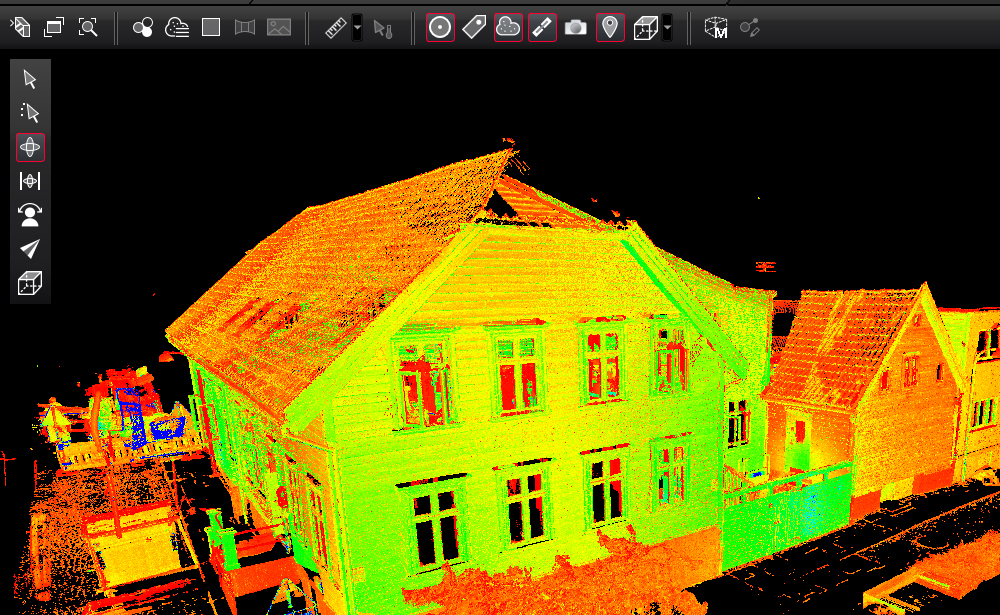
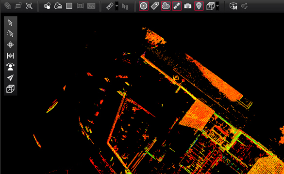
It is the process of taking “raw” data from a laser scanner and performing registration, colorization, and noise reduction. This results in a unified, accurate 3D point cloud that can be used for measurements, BIM modeling, or CAD drafting.
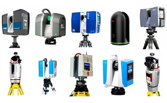
We utilize industry-leading processing engines, including Autodesk ReCap, Leica Cyclone, Faro Scene, and Trimble Business Center. This allows us to handle data from almost any hardware manufacturer.
Yes. We can process raw data from Leica (RTC360, BLK360), Faro (Focus), Trimble (X7, X12), and Z+F scanners. We are also experienced in processing mobile mapping data (SLAM) and drone-based photogrammetry/LiDAR.
We offer several methods depending on the project requirements:
- Target-based Registration: Using spheres or checkerboard targets for the highest survey-grade accuracy.
- Cloud-to-Cloud Registration: Using overlapping geometry to align scans (best for fast-paced interior scans).
- Survey Control: Aligning the point cloud to specific GPS or total station coordinates provided by a surveyor.
We provide a Registration Report for every project. This document details the mean error, overlap percentages, and overall confidence levels of the scan alignment, ensuring the data is reliable for engineering purposes.
Absolutely. Raw scans often contain “noise” from moving people, vehicles, or reflective surfaces (glass/mirrors). We manually and automatically clean the data to ensure you receive a crisp, professional point cloud.
We deliver data in formats compatible with all major BIM and CAD software, including:
- Structured/Unstructured: .RCP, .RCS, .E57
- Generic: .LAS, .LAZ, .XYZ, .PTS
- Web-based: We can also prepare data for online viewers like Leica JetStream or Cintoo.
Yes. If your scanner captured panoramic photos during the scan, we can map those colors onto the point cloud to create a photorealistic 3D environment (RGB point cloud).
For “Massive Data” projects (1,000+ scans), we optimize the dataset by indexing and decimation (thinning) where appropriate. This ensures the final file is manageable for your design team without losing critical detail.
You can upload raw scan folders directly to our secure cloud storage (OneDrive, Google Drive, or WeTransfer). Once the data is received, we perform an initial check to ensure no scans are missing.
For small to medium projects (up to 50 scans), we typically deliver the registered point cloud within 24–48 hours. Larger datasets are scaled accordingly to meet your project deadlines.
Yes. In addition to the point cloud, we can generate 360° virtual tours (similar to Matterport) using your scan data, allowing stakeholders to walk through the site digitally from any browser.
Pricing is typically calculated based on the number of scan stations.This ensures you only pay for the exact volume of data we process.